Visit Uttarakhand to enjoy the beautiful valleys and flora-fauna
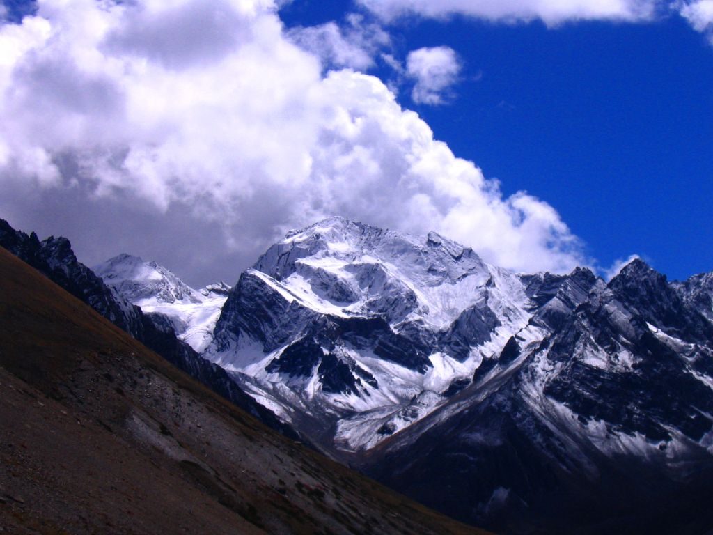
Mana Valley holds great significance in Hindu tradition as this is the place where Maharishi Vyas recited the epic of Mahabharata to god Ganesha. Situated 3 kilometers away from the well known Badrinath Shrine at an elevation of 5,545 meters in the Mana Village, it is the highest motor accessible road in the world and one of the most beautiful valleys in Uttarakhand. The Valley also holds the basis to the extensive tributary of Ganges. The place was used as a trade route between Uttarakhand and Tibet. One must visit the highest accessible pass at the Mana La at 18,192 ft. The Mana Village is called the last village of the country. Some places to visit are Chaukhamba Peak, Vyas Gufa and Ganesha Gufa, the Vasudhara Falls, Satopanth Lake, and Bhim Pul.
Location: Chamoli District, Uttarakhand
Places to Visit: Vasudhara Falls, Satopanth Lake, and Bhim Pul
Things to Do: Enjoy trekking to a few spots
Places to Stay: GMVN Yatri Nivas, GMVN Tourist Rest House Devlok
Famous for: Adventure sports
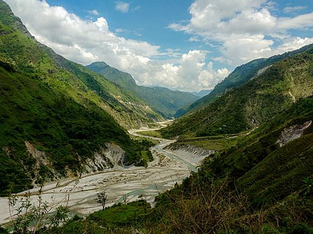
Set with the Flourishing background of the Pindari River, Pittar Valley is one of the most famous valleys in Uttarakhand and is set in the heart of Kumaon Region which is one of the scenic districts of Bageshwar. The valley is popular for its quaint places and the river passes over a sequence of small towns such as Tharali, Kulsari, Deval, Harmani, Meeng, Narain Bagar, and Nalgaon. The River is a branch of the Alaknanda, which it runs into at Karanprayag. One can witness the Pindari glacier from a distance or trek to the glacier.
Location: Bageshwar District, Uttarakhand
Places to Visit: LimeStone Temple at Patal and Bhuvaneshwar falls
Things to Do: Culture trekking tour
Places to Stay: Hotel Holidays Home and Sri Krishna Hotel
Famous for: Small isolated villages such as Deval
Situated between Kuth Yangti Valley and Lassar Yangti Valley, Darma Valley is one of the best valleys of Uttarakhand. A high altitude Himalayan valley nestled in Pithoragarh which can only be visited on foot and falls through the captivating trek to the Panchachuli camp makes for a wonderful experience. Near the proximity to the Indo-Tibetan border, you can observe the lovely glimpse of the Kailash peak. It also holds the mythological value as the Pandavas prepared their last meal on the Panchachuli peak.
Location: Pithoragarh District, Uttarakhand
Places to Visit: Panchachuli Base Camp for glaciers and coniferous forests.
Things to Do: Trekking, camping
Famous for: Adventure sports
Nestled in the western Himalayan region in north India in the Tehri district of Uttarakhand Bhilangana valley along the Bhilangna River. It is a Reserve forest that is reachable to the local and Gujjar communities. The Valley is an enthralling landscape, which hosts some of the most exclusive flora and fauna in the world. Most of the valley falls within the Biosphere Reserve.
Location: Bhilangana Valley, Uttarakhand
Places to Visit: Mussoorie, Tehri Dam, Chamba, Devprayag, Dhanaulti
Things to Do: Soak in the good vibes
Places to Stay: 180 degree resort, Himalayan Eco Lodge Sursingdhar
Famous for: Its enthralling landscape
Johar Valley is also called Milam Valley and Gori Ganga Valley and is one of the best valleys in Uttarakhand . Situated in Uttarakhand state of north India, at the spectacular Coast of Gori Ganga River at an altitude of 1,400 meters. The valley was once used to be a chief route with Indo – Tibet trade. When visiting Johar valley must include the two best villages in the hypnotical valley are Martoli and Milam.
Location: Johar Valley, Gori Ganga river, Uttarakhand
Places to Visit: Almora, Ranikhet, Bhimtal
Things to Do: Watch the mountains and the beautiful rivers
Famous for: Its natural beauty
The Kuthi Valley in Uttarakhand is set in the heart of Pithoragarh district in the eastern part of Uttarakhand state in the Himalayan range of India. The mesmerizing Kuthi valley is the valley just before Tibet border at bank river Kuthi Yankton, in the easternmost region of Kumaun. Atan altitude of 4,630 M Kuthi Yankti appears from slopes near Wilsha and the passes in between Lake Jolingkong. You will love the scenic view of Mangsha Dhura and Lampiya Dhur set at Kuthi valley. The known passes Shimla and Nama adjoins Darma Valley to the lovely Kuthi valley.
Location: Kuthi Valley, Pithoragarh, Uttarakhand
Places to Visit: Jolingkong and Parvati alpine lakes and Baba Kailash
Things to Do: Enjoy the scenic view of Mangsha Dhura and Lampiya Dhur
Places to Stay: Hotel Bala Paradise and Vijay Mount View Resort
Famous for: Its charming and serene places
This Saur Valley is the smallest valley in Uttarakhand. Set in the Pithoragarh district in the state of Uttarakhand. The valley is around 8 kilometers long and 5 kilometers wide, which looks like Kashmir Valley. Set amidst the beautiful mountains, to the south east, and is parted into north and south by a tube like a ridge of slate. Set at an altitude of 5,410 ft, you can have scenic views of the vast snow capped range covering Nanda Devi, Panchachuli Group, Trishuli, from the place called Chandak which hosts an annual fair.
Location: Saur Valley, Pithoragarh, Uttarakhand
Places to Visit: Trishuli, Nanda Devi Panchachuli
Things to Do: Hiking
Places to Stay: Alaknanda Village Homestay and Swami Samarpan Ashram
Famous for: Its panoramic views
The Doon Valley in Uttarakhand is a remarkable valley set within the Shivalik Hills in the Himalayas. This valley in Uttarakhand is wide and long. Enjoy your stay at the capital city Dehradun and indulge in the beauty of nearby places of Uttarakhand. The valley is known for its charming and serene places which offer a gateway to the north traveler to sooth after the scorching summer.
Location: Doon Valley, Dehradun, Uttarakhand
Places to Visit: Mussoorie, Dehradun
Things to Do: Indulge in the beauty of beautiful places
Places to Stay: Doon Valley Homestay
Famous for: Serene places
Har Ki Doon Valley is a crib shaped hanging valley in the Garhwal. Witness the beauty of enclosed by snow capped peaks and high altitude vegetation at one of the best valleys in Uttarakhand. This valley in Uttrakhand is very connected to Baspa Valley via Borasu Pass. This exotic valley is set at an altitude of 11700ft above mean sea level and must be visited around October to March.
Location:Har ki Doon Valley, Uttarakhand
Places to Visit: Yamunotri, Bandarpunch, Borasu Pass
Things to Do: Witness the beauty of snow-capped peaks
Places to Stay: Meraki Sankri Homestay and Pamchgai Homestay
Famous for: Trekking, camping and hidden villages
Tons Valley in Uttarakhand is the major tributary of the Yamuna river and runs from side to side Garhwali region of the state. The Tons got its name after the tons river which is the core source that is set below Dhum Dhar Kandi ridge to Kalanag and Bandarpoonch. This is one of the chief persistent Indian Himalayan rivers.
Location:Tons Valley, Uttarakhand
Places to Visit: Chaukori, Chopta, Dayara Bugyal, Dhanaulti.
Things to Do: Indulge in water sports
Places to Stay: Khanasar Eco Lodge and Hotel Kalindi
Famous for: Temples dedicated to Kauravas
The Valley of Flowers in Uttarakhand is a paradise for nature lovers. One of the most stunning valleys in Uttarakhand popularly known as the Valley of Flowers. One must visit this heaven on earth known as the valley of flowers close to Hemkund Sahib. This is also known as one of the best places for trekking in Uttarakhand. Witness the serene location of Hemkund Sahib is a divine place for the Sikh community which comes under the top Uttarakhand tourist attraction.
Location: Valley of Flowers, Hemkund, Uttarakhand
Places to Visit: Hemkund Sahib, Ghangaria, Gaurikund
Things to Do: Trekking
Places to Stay: Hotel Kuber and Blue Poppy Swiss Cottage
Famous for: Wide variety of flora
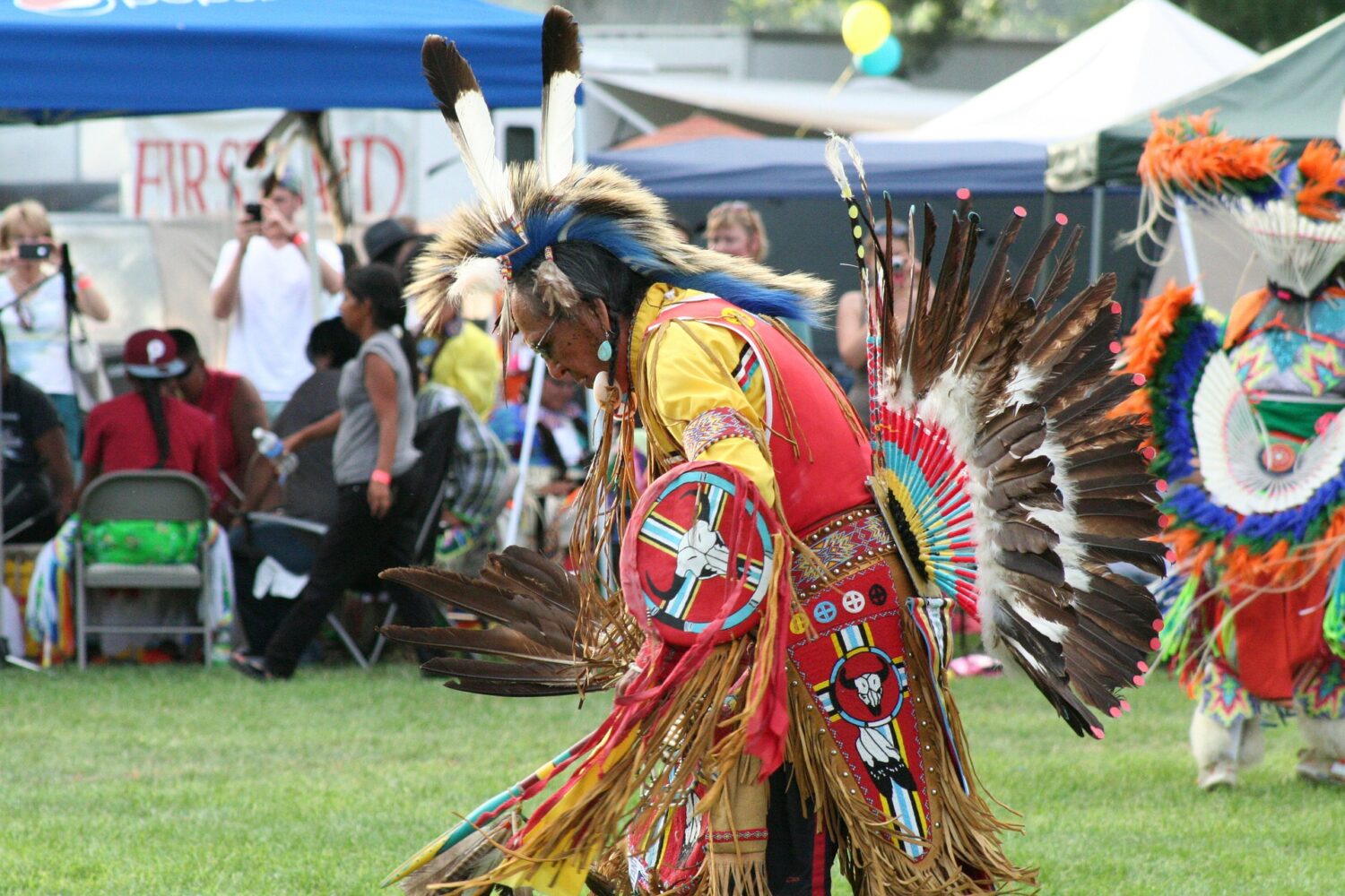
Uttarakhand, A land of diverse people, inclusive tribes, and passionate communities


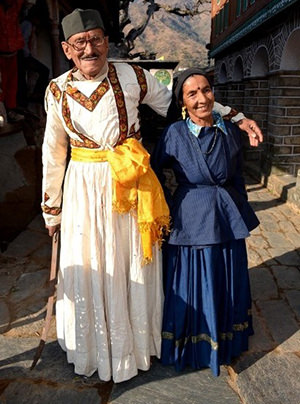


Jaunsar-Bawar is a hilly region in Garhwal division of Uttarakhand, northern India. It is located in the north-west of Dehradun district, along the border with the state of Himachal Pradesh. Jaunsar-Bawar comprises two regions, inhabited by the two predominant groups. Jaunsar, the lower half, while the snow-clad upper region is called Bawar, which includes, the ‘Kharamba peak’ (3,084 metres)
Jaunsari are a tribe found in Jaunsar-Bawar region of the western portion of the state in Garhwal Division. They speak the Jaunsari language which is an Indo-Aryan language. Jaunsari is a generic term for many communities including Khasa and Dom. Under khasas comes Brahmin, Rajput and under Dom comes Bajgi, Luhar and Kolta
Jaunsari community reveres ‘Mahasu Devta ’ which is principal deity of Jaunsari tribes. Dance and music are integral part of Jaunsari culture and during the festivals both men and women dance in the rhythm of folk music. Local people perform folk dances such as Barada Nati, Harul and Raso. Local fairs like Magh Mela and Bissu held to celebrate the harvesting period are very popular among the locals.
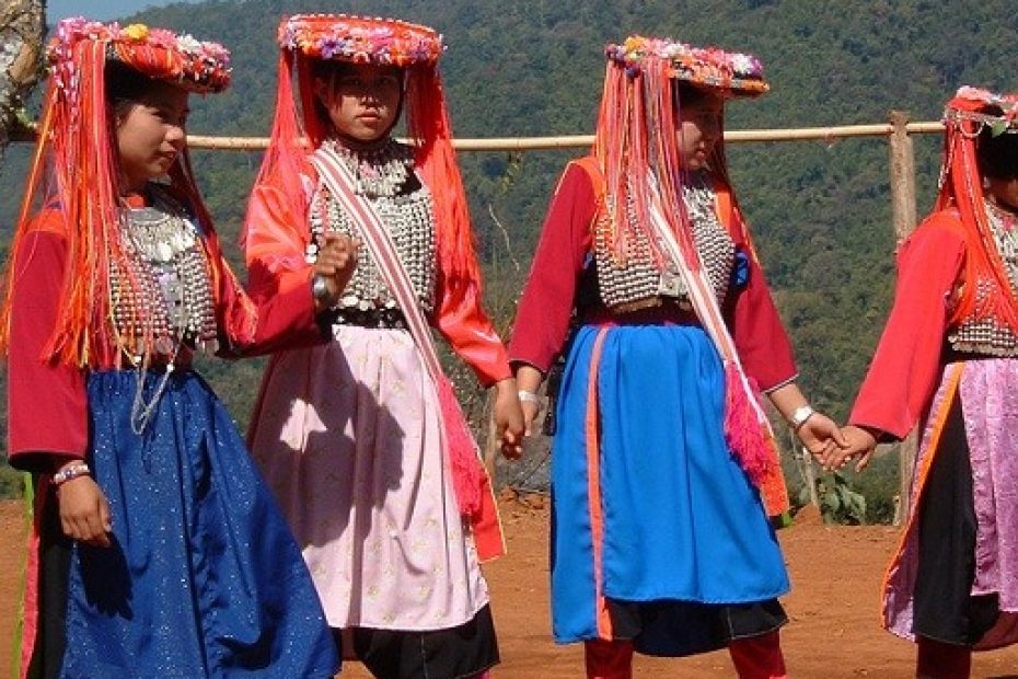
The Bhotias/Bhotiyas also known as Bot are identified as Raghuvanshi Rajput and prefer to be called as Thakur, Rajvanshi or Rung. The Bhotia tribe in Uttarakhand reside in the upper Himalayan valleys of Kumaon and Garhwal.The Bhotia is a generic name that includes the Shaukas of Munsiyari and Rungs of Dharchula in Pithoragarh, Tolchhas and Marchhas of Niti and Mana valleys in Chamoli) and Jads of Harsil from Uttarkashi. Most of these are semi-nomadic pastoral groups brought under one anthropological term – Shauka. The name, Bhotiya (also spelt “Bhotia”), derives from the word Bod which is the Classical Tibetan name for Tibet. It was the term used by the British to refer to these tribals, owing to a presumed resemblance to Tibetans.
Rung Community – A community with compassion
Rung community is an ethnic group from Dharchula in Pithoragarh district of Uttarakhand.The tribal community was featured in popular “ Mann Ki Baat” series by the the Prime Minister of India. The tribe is known for an unparalleled hospitality who love hosting their guests in their homestays.The community is immensely proud of their habitat situated at a great altitude with the Darma Valley offering breathtaking views of the nearby Panchachuli peaks meaning the five-pointed oven
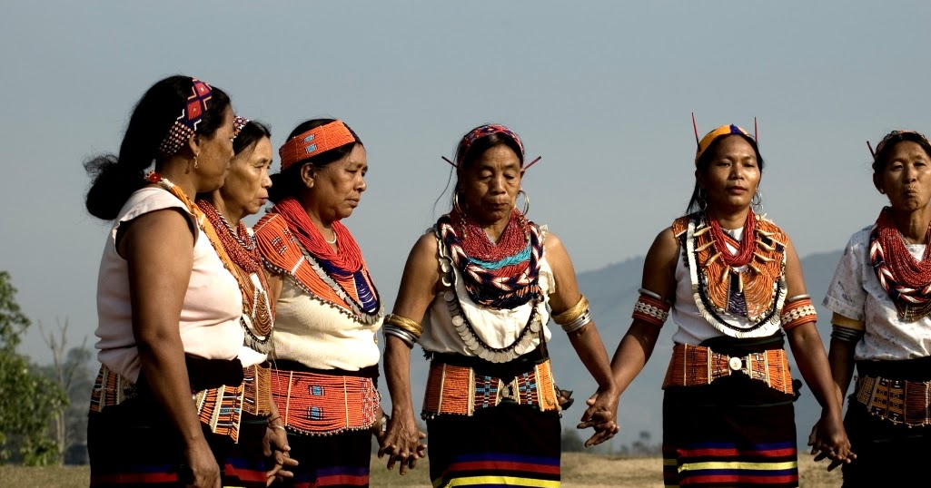
The Buxas are from Mongoloid stock and claim rajput origin. Closely resembling in their habits and customs to Tharus, they are said to be the original inhabitants of the Terai belt and primarily live in Udham Singh Nagar, Dehradun and Pauri Garhwal. They are the followers of Lord Rama and Krishna and worship Hindu deities.
The Raji tribe is one of the smallest tribes of India and is educationally and economically backward tribe of Central Himalayan region of Pithoragarh and Champawat districts in Uttarakhand. The Raji tribe was brought into the light by the then commissioner deputed in Kumaon G.W Trail in 1823. This tribe in the vernacular dialect is known as ‘Van-Rawat’, ‘Vankanhaiya’, ‘Vankhaniya’, ‘Banraut’, ‘Vanmanush’.
The smallest tribal group in Uttarakhand was erstwhile the hunter-gatherers but now they are involved in subsistence-agricultural activities, labor-intensive jobs, carpentry, etc. Anthropologically they belong to the Tibeto- Burman family which originally had a nomadic lifestyle but now they have settled around the Kali River, running between India and Nepal.
The Tharus were once the largest scheduled tribes in the erstwhile state of U.P. and are now concentrated in the Khatima and Sitarganj tehsils of Udham Singh Nagar district. They claim their ancestry from Kirata. They have been regarded as the descendants of the Rajputs by some researchers, while some others trace their origin from the Mongols of Central Asia. The language used by the Tharu’s is heavily influenced by Hindi and Nepali.
The tribe inherently follows a joint family system and the Biradari Panchayat is the political organization of the Tharus. The Tharus also believe in 36 deities, as well as believed to be practicing witchcraft, sorcery and sacrifices. They offer sacrifices to all their deities except Jagannathi Devta, who is offered only milk. They are primarily into agriculture and the community is also an expert in fishing. Surprisingly, as a fact the women do not eat the fish touched by men and so the men and women fish separately.
Tourist Map
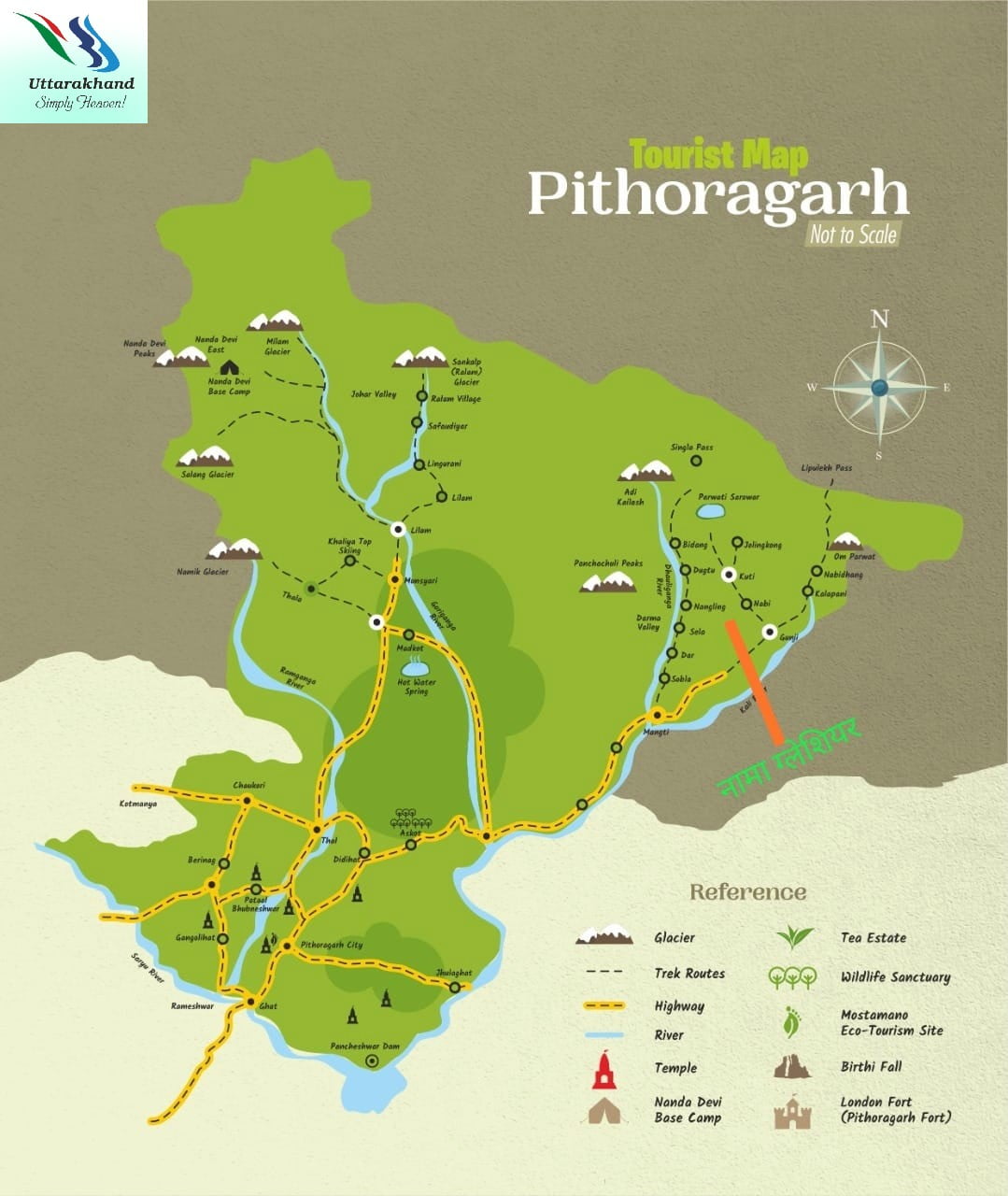
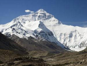
Adi Kailash
Adi Kailash, also known as Shiva Kailash, Chota Kailash, Baba Kailash or Jonglingkong Peak, is a mountain located in the Himalayan mountain range in the Pithoragarh district of Uttarakhand, India.
Parvati Sarovar

Parvati Sarovar is a holy lake located at an elevation of 4,497mts near the peak of Adi Kailash. A shrine of Lord Shiva and Goddess Parvati lies at the shore of the lake. Devotees trekking towards Adi Kailash, pray at the shrine. on Aadi Kailash trekOn the foothills of Aadi Kailash peak of Pithoragarh district of Uttarakhand, India.
Panchachuli Peaks
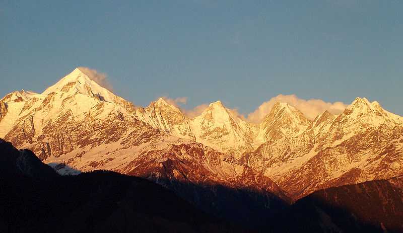
The Panchchuli peaks are a group of five snow-capped Himalayan peaks lying at the end of the eastern Kumaon region, near Dugtu Village Darma valley. The peaks have altitudes ranging from 6,334 metres to 6,904 metres. They form the watershed between the Gori and the Darmaganga valleys
Milam Glacier

Milam, one of the most beautiful glaciers of the world is in district Pithoragarh located at the height of 4250 meters above sea level. This glacier has been named after a village Milam located at 3 k.m. away from the Milam Glacier. In ancient time, Milam village was the most populous village of district Pithoragarh but at present its population is almost zero. But its importance is still maintained due to the world’s famous glacier – Milam.River Gori Ganga,a tributary of the river Kali starts from the Milam Glacier.
Askot Sanctuary
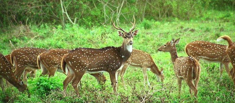
Askot Musk Deer Sanctuary is located 54 km from Pithoragarh near Askot in Uttarakhand state of India. This sanctuary has been set up primarily with the object of conserving the musk deer and its habitat.
Nanda Devi Peak & Base Camp

Nanda Devi, the second-highest mountain in India, constitutes a pair of massive peaks, namely Nanda Devi East (7,816 m) and Nanda Devi West (7,434 m). The Nanda Devi East affords unmatched views of the two peaks and is as close as one can get to their beauty. The trekkers enjoy serenity beginning from the beautiful settlement of Munsiyari. The trail snakes through dense bamboo forests, verdant alpine meadows, rustic villages, and some of the deepest gorges in the country!
The trek may also reward one with an extremely rare glimpse of the Himalayan Musk Deer, and Snow Leopard. It also introduces trekkers to the culture of the Johari Tribe, which are native to Munsiyari.
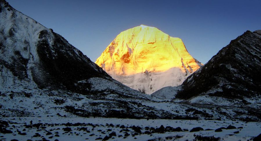
Om Parvat
The mighty peak of Om Parvat lies in the Dharchula district of western Nepal and in Pithoragarh District, Uttarakhand, India and is very close to Adinath peak as well. The peak rises to a massive height of 6191 metres from the bosom of the surrounding mountains making this destination is an important landmark en route Kailash Mansarovar Yatra.
One of the most bewitching details of this attraction is the fact that the snow deposition pattern on the surface of the mountain resembles the sacred 'OM', which is an important symbol in Hinduism. Owing to the same, it is considered as an important religious site by Hindus. With a great resemblance to Mount Kailash in Tibet, the view is simply magnificent and enchanting.
Mahakali Temple of Gangolihat

Tehsil and block Gangolihat is at a distance of 77 Km. from Pithoragarh. It is rich in folk culture, music and religious traditions and had been chosen by Sankaracharya for the installation of Mahakali shaktipith. Amidst the cluster of pine trees is situated the shakti temple. The Goddess Kali as represented in her fierce form conquering the demon, is offered sacrifices of lambs and goats. In the direction opposite of the Kali temple about 2 Km. away is situated the Chamunda temple which is believed to be in the centre of an area of wilderness exclusively possessed by spirits and demons conquered by the Goddess in her fierce aspect. The temple has an aura of mystery and weird charm and during the dark hours of night the spirits are believed to have a free sway outside the temple premises.
Patal Bhuvaneshwar

The exposure of Patal Bhuvaneshwar (Lord Shiva in the underground temple complex) is one of this unique way to help mankind. 16 Km. to the north-east of Gangolihat and 20 Km. to the south of Berinag is situated the Patal Bhuvaneshwar cave temple. It is 91 Km. away from the district head quarter and situated at a height of 1350 meters above sea level. The temple place comes under village Bhuvneshwar which is in the tehsil Didihat.The way to the temple is through a narrow tunnel shaped cave, giving a very thrilling experience. The main passage way opens into several small caves which have in them the stone carvings of many traditional Gods & Goddesses and can evoke weird romantic fancies and images in the religiously inclined person. The cave temple of Patal Bhuvaneshwar is traditionally believed to be the abode of thirty three crore deities.
Mostamanu
The Motamanu Temple, Pithoragarh is one of the city’s most visited destinations. This temple is located near Pithoragarh Fort, about 6 km from the main Pithoragarh town. This temple is dedicated to God Mosta, which is considered as the god of this region. Devotees of God Mosta travel far and away while worshiping the deity and receive blessings in the form of prosperity and welfare. In order to celebrate the divine presence of Lord Mouza, a local fair is also organized in the month of August-September, which includes a large number of devotees, travelers, tourists etc. The temple of this hill shows an enchanted view of the entire city and the high valley. The temple complex is large and you can spend some special time here. The pure atmosphere of the temple, body and soul reaches utmost comfort
Pancheshwar Dam

Pancheshwar Dam is a rock-fill dam which is being constructed on the Sarda River(also known as Mahakali in Nepal), which forms the international boundary between India and Nepal.
Jhulaghat

This small town on the Indo-Nepal border is named after a hanging bridge on the Kali River. One can enter Nepal through this bridge. The small market here deals in Nepali goods and other electronic items.
Berinag - The town of Snake Temples

Being garnered with nature’s ethereal beauty, the kaleidoscopic Berinag is nestled in the Pithoragarh district of Uttarakhand. With the word 'Nag' or snake in its name, Berinag is not as precarious as it sounds and is more of a visitor's delight.
Berinag sits at an average elevation of 1,860 meters, about 6,100 feet above sea level and was once popular by the name of Berinag. This place is famous for its ancient snake temples which have been erected in the town itself. Some of the famous attractions located in the proximity of Berinag are Didihat, Patal Bhuvaneshwar and Chaukori.
Thal

A pilgrim spot that is reached through a narrow pathway, the Thal Kedar is nestled at an elevation of 880 meters above sea level. The place is famous for its ancient temple dedicated to Lord Shiva and is mentioned in the ancient text of the Skanda Purana. The location also offers some really amazing views of the valley and is attracts several tourist during the festival of Shivratri every year.
Didihat
Didihat is a town and a Nagar Palika in Pithoragarh District in the state of Uttarakhand, India. It is one of the eleven administrative subdivisions of Pithoragarh district and also serves as its administrative headquarters.With a population of 6522, Didihat is located at a distance of 520 km (320 mi) from the state capital Dehradun.
Didihat is named after the Kumauni word 'Dand' meaning a small hillock. Didihat falls on the pilgrimage route to Kailash Mansarovar.
Chaukori

Chaukori is a hill station in the Pithoragarh district set among the lofty peaks of the western Himalayan Range in the Kumaon Division of Uttarakhand, India. To its north is Tibet and to its south is Terai. The Mahakali River, running along its eastern boundary, forms the Indo-Nepal international border. This place has become a prominent tourist place and from here a wide and picturesque view of Himalayan range can be viewed. The golden yellow colour of sun rays falling on the Himalayan range in the morning time is really worth seeing. There are cottages available here where one can stay and enjoy the serene surroundings. Tourists coming to this place generally also visit the nearby tourist places like Patal Bhuvaneshwar, Kausani, Bageshwar and Almora.
Namik Glacier
“Namik”, which means the presence of saline water springs, defines the glacier located at 3600 metres, in the Pithoragarh District of Uttarakhand. This glacier is prominently known for the Trek leading upto the glacier, which promises adventure enthusiasts a thrilling and mesmerising journey.
In the lap of nature, surrounded by the splendour of peaks like Nanda Devi, Trishul, Nanda Kot and waterfalls along with sulphur springs, this trek has a lot to offer to tourists. The trek, which falls on an ancient Indo-Tibetan trade route, also promises a dose of local culture as the trail passes through pristine villages with their own independent and strong local cultures. These villages are rich in heritage; two villages, Gogina and Namik, deserve special mention. Did you know, Namik Glacier is also the source for Ramgana River, and thus the trail broadly follows the River through a unique combination of forests and meadows, with the eternal Himalayas in constant view.
The base for the trek starts at Chaukori-Munsiyari (2290 metres) and follows a trail through Senar Gad Meadows, Dhaldauk, Sudam Khan, Hiramani Glacier and finally ends at Namik Glacier. Due to the challenging nature of the trek, which goes on for 59 Kms (one way), people are well-advised to set aside 10 days (minimum) to savour the beauty of the journey.
May, June, September and October are the best months to go on this trek.
Khaliya Top

Khaliya top is the best location for adventure lover, Khaliya top of Munsiyari town, a Tehsil and Sub Division in the Pithoragarh District in the hill-state of Uttarakhand is situated almost 11500ft above the sea level hidden amidst the alpine trees with scenic views of Panchachuli peaks along the whole trek
Johar Valley
Johar Valley (also known as Milam Valley or Gori Ganga Valley) is a valley located in Uttarakhand, India, along the Gori Ganga river. The valley used to be a major trade route with Tibet. The best known villages in the valley are Martoli and Milam.
Madkot

Madkot is a scenic village in Pithoragarh district. It is about 21 km away from popular hill station Munsiyari, through typical hilly roads. Madkot is popular among tourists for its:
- Hot water spring
- Vegetation
- Snowfall
- Natural beauty
- And rich culture of local Bhotiya tribes.
It sits at an elevation of about 2,200 m (7,200 ft) above sea level. After visiting Khaliya top, Madkote is the place which is worth visiting.
Darma Trek - Valley of Remote Villages

A lesser-known valley, the picturesque Darma Valley (or Darma Ganga Valley) is nestled between two other valleys, namely the Kuthi Yangti Valley in the east and Lassar Yangti Valley in the west.
Perched at an altitude of 3470 mts, Darma Valley is formed by the Darma River (also known as Darma Ganga River) and offers stunning views of the Panchachuli peaks.
Darma Valley trek and Panchachuli Base Camp Trek follows the same route, the only difference is that trekkers are going to explore the vicinity of Darma Valley more deeply.
Om Parvat

Snow treks are some of the most fascinating things to do in the Himalayas. And if you add to that some mystery and a certain aspect of mythology, the enthusiasm to complete the trek reaches new heights. That is what the Om Parvat trek is about. Mythologically speaking, this place is considered to be one of the oldest abode of Lord Shiva. Related to the legend of Ravana, the peak is considered sacred by many, and the Om Parvat trek leads to an astounding view of the giant and the impression of 'OM' made on the facade by the snow.
Located in the snowy Himalayas of the Kumaon region in Uttarakhand, the Om Parvat trek starts and ends in Kathgodam, passing through many small towns and villages to finally arrive at the magnificent view of the Om Parvat. Rising to an altitude of 14816 ft, this peak is also referred to by several other names such as Adi Kailash, Chota Kailash, Baba Kailash, and Jonglingkong. A virgin peak largely because of its religious significance, the most astounding trait of this peak is the miraculous impression of “OM” naturally formed with the deposition of snow against the black background of the mountain.
Kuti Village
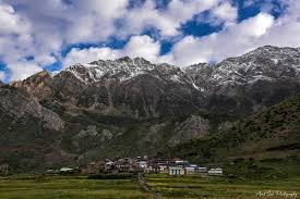
Dharchula town is encircled by many small villages. Kuti village is one of them. Kuti village is a culturally vibrant village with over 115 traditional houses. It is one among the 73 villages of Dharchula Block of Pithoragarh district. This place is a major halt for people proceeding to the Adi Kailash trek.